
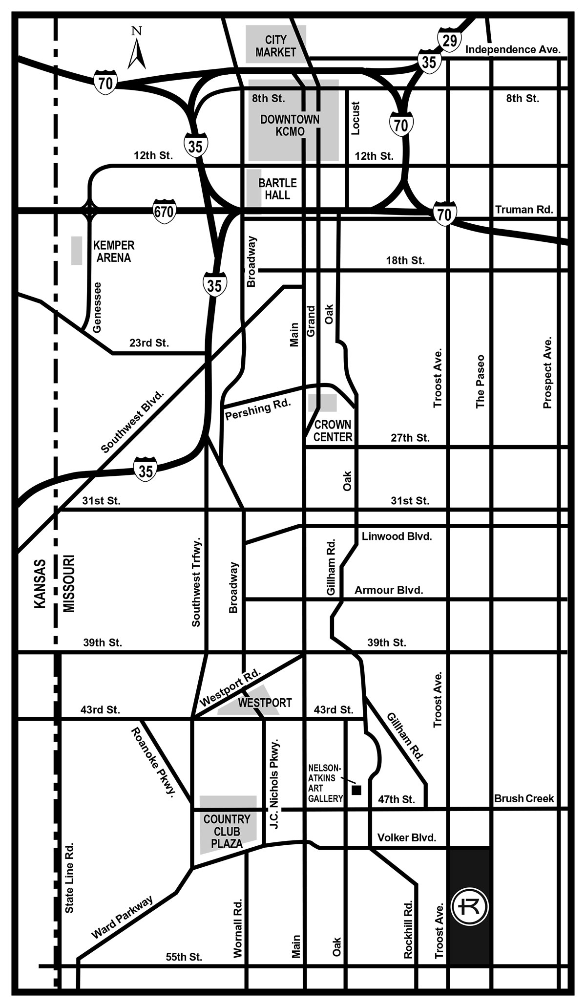
Detailed description of the map
This map shows the central area of Kansas City, Missouri, with major highways, streets, and landmarks labeled. Interstate 70 runs east to west near the top of the map, while Interstate 35 runs north to south through the city. Interstate 670 connects across the downtown area.
Downtown Kansas City is located near 8th Street and 12th Street, with Bartle Hall identified nearby. To the west of downtown is Kemper Arena. South of downtown along Broadway is Crown Center, located near Pershing Road.
Further south, Westport appears near 43rd Street and Westport Road. The Country Club Plaza is shown near 47th Street and J.C. Nichols Parkway. The Nelson-Atkins Art Gallery is located just east of the Plaza. Rockhurst University is 2-3 blocks southeast of Nelson-Atkins and the Plaza.
Major north-south streets include Broadway, Main Street, Oak Street, Troost Avenue, and Prospect Avenue. East-west streets include 12th Street, 18th Street, 27th Street, 31st Street, 39th Street, 43rd Street, and 47th Street.
Southwest Trafficway runs diagonally through the western portion of the map. The Kansas–Missouri state line is shown along the left side. A north arrow at the top indicates orientation.